NEBRASKA WEATHER
John 3:16
For God so loved the world that he gave his one and only Son, that whoever believes in him shall not perish but have eternal life.
–Read the Bible -Bible Gateway
WARNING:
Do not depend on the internet/cell for severe weather information.
Instead, listen to your local radio & TV stations and NOAA weather radio
for up-to-date weather information. Use weather data at your own risk.
Always Check Time and Date of Each Product.
Hit Refresh/Reload for the Latest Product.
NWS Weather Forecast Offices:
–Cheyenne –Goodland –Hastings
–North Platte –Omaha –Sioux Falls
NWS Weather Forecast Offices: Social Media
–Facebook –IEM –Twitter -Cheyenne
–Facebook –IEM –Twitter -Goodland
–Facebook –IEM –Twitter -Hastings
–Facebook –IEM –Twitter -North Platte
–Facebook –IEM –Twitter -Omaha
–Facebook –IEM –Twitter -Sioux Falls
A
Convective Outlooks: Storm Prediction Center
–Day 1 –Day 2 –Day 3 –Day 4-8 –Convective Outlooks
–SPC –Mesoscale Discussions
–SPC –Storm Reports
–SPC –Watches
–Day1 –Day 2 –Day 3 -Nebraska
–Day 1 –Day 2 –Day 3 -Cheyenne
–Day 1 –Day 2 –Day 3 -Goodland
–Day 1 –Day 2 –Day 3 -Hastings
–Day 1 –Day 2 –Day 3 -North Platte
–Day 1 –Day 2 –Day 3 -Omaha
–Day 1 –Day 2 –Day 3 -Sioux Falls
Convective Outlooks: College of Du Page
–COD –Convective Outlooks
–COD –Mesoscale Discussions
–COD –Storm Reports
–COD –Watches
Convective Outlooks; Colorado State University
–Machine Learning Probabilities Prediction Webpage
Convective Outlooks: Nadocast
–Nadocast
Convective Outlooks: Pivotal Weather
–Day 1 –Day 2 –Day 3 -United States
–Day 1 –Day 2 –Day 3 -Central Plains
–Day 1 Outlook 4-Panel -Central Plains
–Categorical –Tornado –Hail –Wind -Central Plains
Area Forecast Discussion:
–COD –NWS -Cheyenne
–COD –NWS -Goodland
–COD –NWS -Hastings
–COD –NWS -North Platte
–COD –NWS -Omaha
–COD –NWS -Sioux Falls
Experimental Hazardous Weather Outlook:
–Cheyenne –Goodland –Hastings
–North Platte –Omaha –Sioux Fallls
Hazardous Weather Outlook:
–COD –NWS -Cheyenne
–COD –NWS -Goodland
–COD –NWS -Hastings
–COD –NWS -North Platte
–COD –NWS -Omaha
–COD –NWS -Sioux Falls
Radar Images:
–COD –NWS -Cheyenne
–COD –NWS -Goodland
–COD –NWS -Hastings
–COD –NWS -North Platte
–COD –NWS -Omaha
–COD –NWS -Sioux Falls
SEVERE WEATHER
Watches, Warnings or Advisories: Maps
Watches, Warnings or Advisories: By County
Air Quality Alert:
-COD -NWS -Cheyenne
-COD -NWS -Goodland
-COD -NWS -Hastings
-COD -NWS -North Platte
-COD -NWS -Omaha
-COD -NWS -Sioux Falls
Experimental Graphical Hazardous Weather Outlook:
–Cheyenne –Goodland –Hastings
–North Platte –Omaha –Sioux Fallls
Hazardous Weather Outlook:
–COD –NWS -Cheyenne
–COD –NWS -Goodland
–COD –NWS -Hastings
–COD –NWS -North Platte
–COD –NWS -Omaha
–COD –NWS -Sioux Falls
Local Storm Reports:
–COD –NWS -Cheyenne
–COD –NWS -Goodland
–COD –NWS -Hastings
–COD –NWS -North Platte
–COD –NWS -Omaha
–COD –NWS -Sioux Falls
Non-Precipitation: Warnings/Watches/Advisories
-COD -NWS -Cheyenne
-COD -NWS -Goodland
-COD -NWS -Hastings
-COD -NWS -North Platte
-COD -NWS -Omaha
-COD -NWS -Sioux Falls
Public Information Statement:
-COD -NWS -Cheyenne
-COD -NWS -Goodland
-COD -NWS -Hastings
-COD -NWS -North Platte
-COD -NWS -Omaha
-COD -NWS -Sioux Falls
Severe Thunderstorm Warning:
–COD –NWS -Cheyenne
–COD –NWS -Goodland
–COD –NWS -Hastings
-COD –NWS -North Platte
–COD –NWS -Omaha
–COD –NWS -Sioux Falls
Severe Weather Statement:
–COD –NWS -Cheyenne
–COD –NWS -Goodland
–COD –NWS -Hastings
–COD –NWS -North Platte
–COD –NWS -Omaha
–COD –NWS -Sioux Falls
Special Weather Statement:
–COD –NWS -Cheyenne
–COD –NWS -Goodland
–COD –NWS -Hastings
–COD –NWS -North Platte
–COD –NWS -Omaha
-COD –NWS -Sioux Falls
Tornado Warning:
–COD –NWS -Cheyenne
–COD –NWS -Goodland
–COD –NWS -Hastings
–COD –NWS -North Platte
–COD –NWS -Omaha
–COD –NWS -Sioux Falls
Watch County Notification:
-COD -NWS -Cheyenne
-COD -NWS -Goodland
-COD -NWS -Hastings
-COD -NWS -North Platte
-COD -NWS -Omaha
-COD -NWS -Sioux Falls
Winter Weather: Warnings/Watches/Advisories
-COD -NWS -Cheyenne
-COD -NWS -Goodland
-COD -NWS -Hastings
-COD -NWS -North Platte
-COD -NWS -Omaha
-COD -NWS -Sioux Falls
-COD -NWS -Cheyenne
-COD -NWS -Goodland
-COD -NWS -Hastings
-COD -NWS -North Platte
-COD -NWS -Omaha
-COD -NWS -Sioux Falls
AGRICULTURE
AVIATION
CLIMATE
Annual Climatological Report:
COCORAHS Precipitation Summary:
Daily Climate Report:
–COD -NWS -Alliance
–COD -NWS -Broken Bow
–COD -NWS -Chadron
–COD -NWS -Grand Island
–COD -NWS -Hastings
–COD -NWS -Imperial
–COD -NWS -Kearney
–COD -NWS -Lincoln
–COD -NWS -McCook
–COD -NWS -Norfolk
–COD -NWS -North Platte
–COD -NWS -Omaha
–COD -NWS Ord
–COD -NWS -Scottsbluff
–COD -NWS -Sidney
–COD -NWS -Valentine
–COD -NWS -Valley
Midwest Climate Watch:
–Purdue University
Monthly Climatological Report:
National High & Low Temperatures:
–WPC
Preliminary Local Climatological Data:
Record Event Report:
Regional Max/Min Temp & Precipitation Table:
–COD –NWS -Cheyenne
–COD –NWS -Goodland
–COD –NWS -Hastings
–COD –NWS -North Platte
–COD –NWS -Omaha
–COD –NWS -Sioux Falls
–COD –NWS -Nebraska
Seasonal Climatological Report:
CURRENT WEATHER
Hourly Weather Roundup:
–COD –NWS -Nebraska
–COD –NWS -Colorado
–COD –NWS -Iowa
–COD –NWS -Kansas
–COD –NWS -Missouri
–COD –NWS -South Dakota
–COD –NWS -Wyoming
FIRE WEATHER
Fire Weather Forecast:
–COD –NWS -Cheyenne
–COD –NWS -Goodland
–COD –NWS -Hastings
–COD –NWS -North Platte
–COD –NWS -Omaha
–COD –NWS -Sioux Falls
Red Flag Warning:
-COD -NWS -Cheyenne
-COD -NWS -Goodland
-COD -NWS -Hastings
-COD -NWS -North Platte
-COD -NWS -Omaha
-COD -NWS -Sioux Falls
FORECAST:
Area Forecast Discussion:
–COD –NWS -Cheyenne
–COD –NWS -Goodland
–COD –NWS -Hastings
–COD –NWS -North Platte
–COD –NWS -Omaha
–COD –NWS -Sioux Falls
-COD -NWS -Denver
-COD -NWS -Des Moines
-COD -NWS -Dodge City
-COD -NWS -Topeka
-COD -NWS -Wichita
Area Forecast Matrices:
-COD -NWS -Cheyenne
-COD -NWS -Goodland
-COD -NWS -Hastings
-COD -NWS -North Platte
-COD -NWS -Omaha
-COD -NWS -Sioux Falls
BUFKIT:
-Iowa State –Penn State
Excessive Rainfall Forecasts:
–Interactive –WPC
Forecast Cities: NWS
Forecast Counties: NWS
Forecast Meteograms Generator:
Forecast Models:
–College of Du Page –Pivotal Weather –WeatherBELL –Weathermodels
Forecast Surface Charts: WPC
–Day 1/2-2 1/2 –Day 3-7 -Legacy Page
-Day 1/2-2 1/2 –Day 3-7
Forecast: TV Stations
Hourly & Tabular Forecast:
IDSS Forecast Points:
Long-Range Forecasts:
–6 to 10 Day Outlooks
–8 to 14 Day Outlooks
–Week 3-4 Outlooks –Official 30-Day Forecasts
–Climate Prediction Center
–Blocking –ENSO –MJO
–Recent Anomalies –Teleconnections
NBM ID Viewer:
NDFD GIS Graphics:
–Cheyenne –Goodland –Hastings –Home
–North Platte –Omaha –Sioux Falls
NDFD Graphical Forecasts:
–Cheyenne –Goodland –Hastings
–North Platte –Omaha –Sioux Falls
Quantitative Precipitation Forecasts:
–Legacy Page –WPC
Tabular State Forecast:
–COD –NWS -Nebraska
Weather Prediction Center Discussions:
–COD –WPC -Short Range Forecast Discussion
–COD –WPC -Extended Forecast Discussion
–COD -WPC -Hazards Outlook
–COD –WPC -Excessive Rainfall Discussion
–COD –WPC -Heavy Snow & Icing Discussion
–COD –WPC -Mesoscale Precipitation Discussions
Zone Forecast Product:
–COD –NWS -Cheyenne
–COD –NWS -Goodland
–COD –NWS -Hastings
–COD –NWS -North Platte
–COD –NWS -Omaha
–COD –NWS -Sioux Falls
HYDROLOGY
Advanced Hydrologic Prediction Service:
Flash Flood Statement:
Flash Flood Warning:
Flash Flood Watch:
Flood Statement:
Flood Warning:
Flood Watch:
Hydrologic Summary:
Mesoscale Precipitation Discussions:
–WPC
River Forecast Center:
Significant River Flood Outlook:
–WPC
Lightning:
–Nebraska –Central Plains –Kansas –Midwest
Radar Images: AccuWeather
Radar Images: Aviation Weather Center
Radar Images: Baron
–Live Weather
Radar Images: College of Du Page
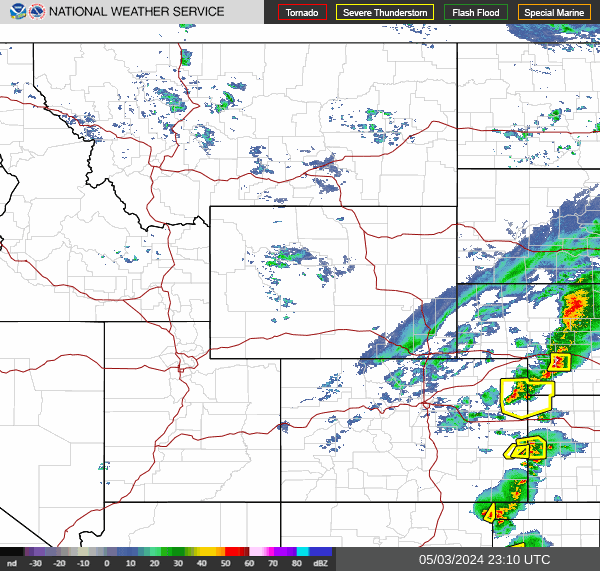
Radar Images:
–COD –NWS -Cheyenne
–COD –NWS -Goodland
–COD –NWS -Hastings
–COD –NWS -North Platte
–COD –NWS -Omaha
–COD –NWS -Sioux Falls
–COD -Central Plains
–COD -Nebraska
-COD –NWS -Northern Rockies
-COD –NWS -Southern Plains
-COD –NWS -United States
-COD –NWS -Upper Mississippi Valley
Radar Image: MRMS
Radar Images: National Weather Service
Radar Images: Plymouth State University:
Radar Images: University of Wisconsin
WSR-88D Radar Outage Notification:
Satellite Images: NESDIS
–N. Rockies –Upper Mississippi Valley –USA –CAN -Day Cloud Phase/Nigh Microphysics
–N. Rockies –Upper Mississippi Valley –USA –CAN -GeoColor
–N. Rockies –Upper Mississippi Valley –USA –CAN -GLM Flash Extent Density
–N. Rockies –Upper Mississippi Valley –USA –CAN -Longwave IR
–N. Rockies –Upper Mississippi Valley –USA –CAN -Sandwich RGB
–N. Rockies –Upper Mississippi Valley –USA –CAN -Shortwave IR
–N. Rockies –Upper Mississippi Valley –USA –CAN -Visible
–N. Rockies –Upper Mississippi Valley –USA –CAN -Water Vapor
–Cheyenne –Goodland –Hastings –North Platte –Omaha –Sioux Falls
SOUNDINGS
SURFACE
UPPER AIR
WINTER WEATHER
Winter Weather Warnings/Watches/Advisories:
Area Forecast Discussion:
Heavy Snow & Icing Discussion:
–COD –WPC
Local Storm Reports:
–COD –NWS -Cheyenne
–COD –NWS -Goodland
–COD –NWS -Hastings
–COD –NWS -North Platte
–COD –NWS -Omaha
–COD –NWS -Sioux Falls
National Snow Analysis:
–NOHRSC
NDFD Graphical Forecast: Snow Amount
Probabilistic Snowfall Experiment:
Road Conditions:
Snow Cover:
Snowfall Probability Forecasts:
–Day 1 –Day 2 –Day 3 -4 inches or more
–Day 1 –Day 2 –Day 3 -8 inches or more
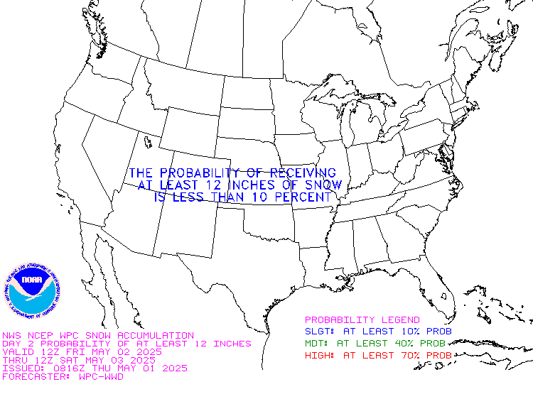
–Day 1 –Day 2 –Day 3 -12 inches or more
Snowfall Reports from the Last 24 Hours:
Total Ice Accumulation Forecast:
Total Snow Forecast:
Winter Probabilistic Precipitation Guidance:
–WPC
Winter Storm Outlook Experimental:
–WPC
Winter Weather Forecasts:
–Legacy Page –WPC
Winter Weather Severity Index:
DISCLAIMER:
This web site is for information use only.
Use weather data at your own risk, due to internet interruption,
outages, cell phone problems, etc. Timely delivery of weather data/products is not guaranteed through the internet, cell phone, etc.
Mike Geukes will not be held liable/responsible for how you use the weather data. Web Site Created by Mike Geukes. Copyright 2022. All Rights Reserved.