WEST MICHIGAN WEATHER
John 3:16
For God so loved the world that he gave his one and only Son,
that whoever believes in him shall not perish but have eternal life.
–Bible Gateway –Bible Study Tools
WARNING:
Do not depend on the internet/cell for severe weather information.
Instead, listen to your local radio & TV stations and NOAA weather radio
for up-to-date weather information. Use weather data at your own risk.
Always Check Time and Date of Each Product.
Hit Refresh/Reload for the Latest Product.
State Weather Text Pages:
–Michigan –Illinois –Indiana –Iowa –Kansas –Minnesota –Missouri
–Nebraska –North Dakota –Ohio –South Dakota –Wisconsin
–Oklahoma –Texas
–Colorado –Florida –Montana –New Mexico –Wyoming
SOCIAL MEDIA
–Facebook –Twitter –NWS Detroit
–Facebook –Twitter –NWS Gaylord
–Facebook –Twitter –NWS Grand Rapids
–Facebook –Twitter –NWS Marquette
–Facebook –Twitter –NWS North Webster
–Facebook –Twitter –National Hurricane Center
–Facebook –Twitter –Storm Prediction Center
–Facebook –Twitter –Weather Prediction Center
CONVECTIVE OUTLOOKS
Convective Outlooks: Storm Prediction Center
–Day 1 –Day 2 –Day 3 –Day 4-8 –Convective Outlooks
–SPC –Mesoscale Discussions
–SPC –Storm Reports
–SPC –Watches
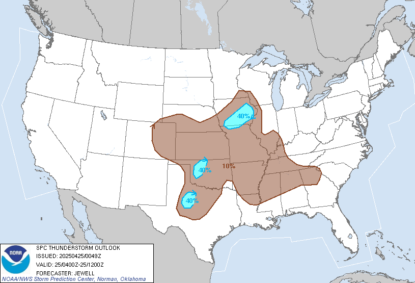
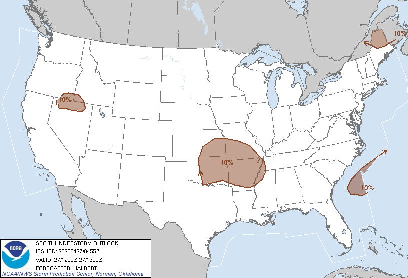
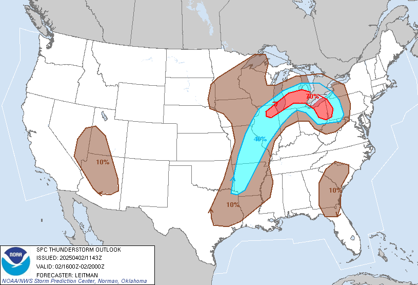
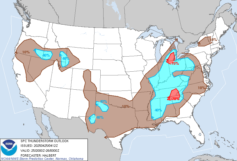
–00-04Z –04-12Z –12-16Z –16-20Z –20-00Z –Thunderstorm Outlooks
Convective Outlooks: College of Du Page
–COD –Convective Outlooks
–COD –Mesoscale Discussions
–COD –Storm Reports
–COD –Watches
Convective Outlooks; Colorado State University
–Machine Learning Probabilities Prediction Webpage
Convective Outlooks: Nadocast
–Nadocast
Convective Outlooks: Pivotal Weather
–Day 1 –Day 2 –Day 3 -United States
–Day 1 –Day 2 –Day 3 -Midwest
Maps Only Below:
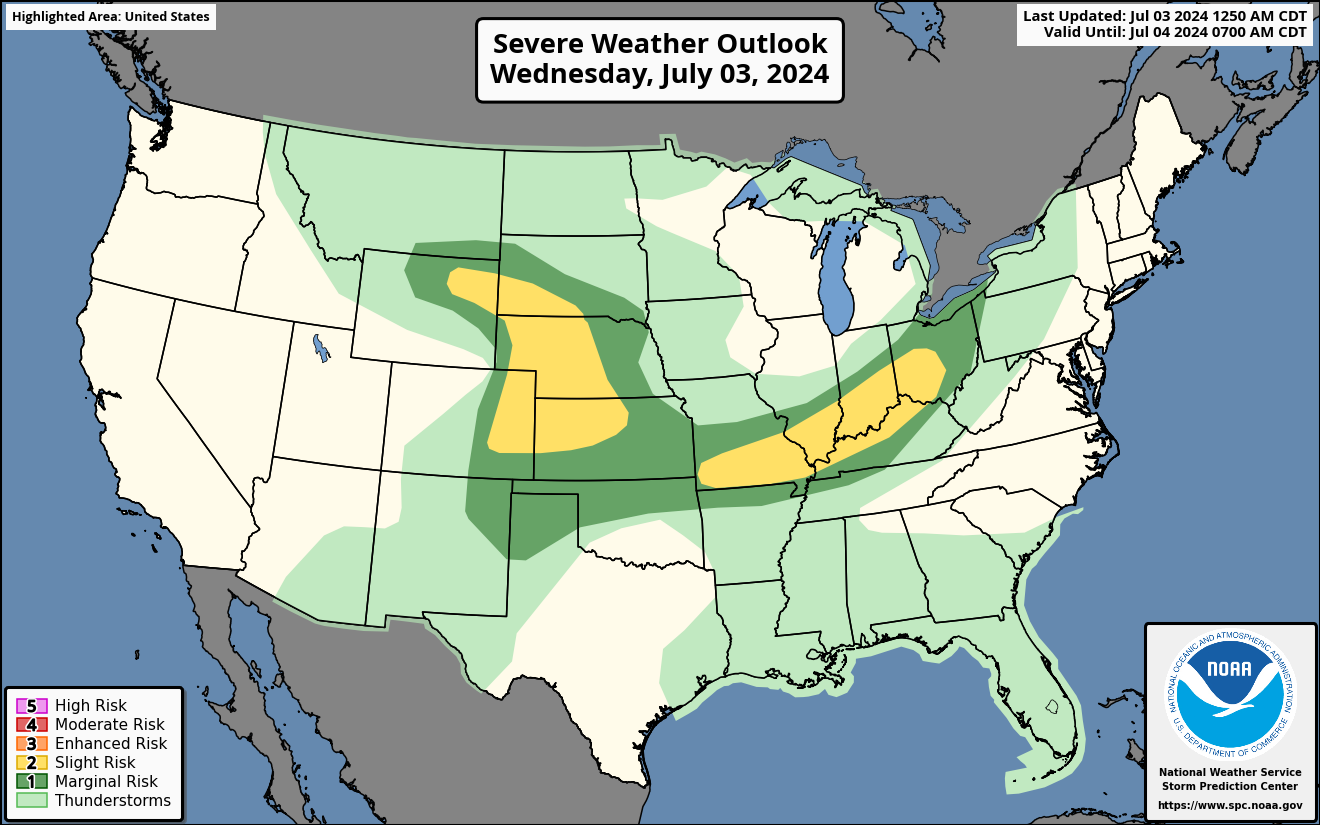
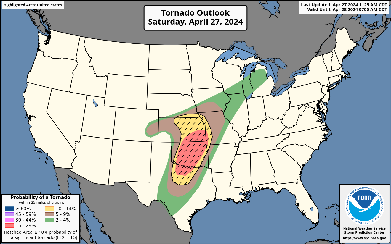
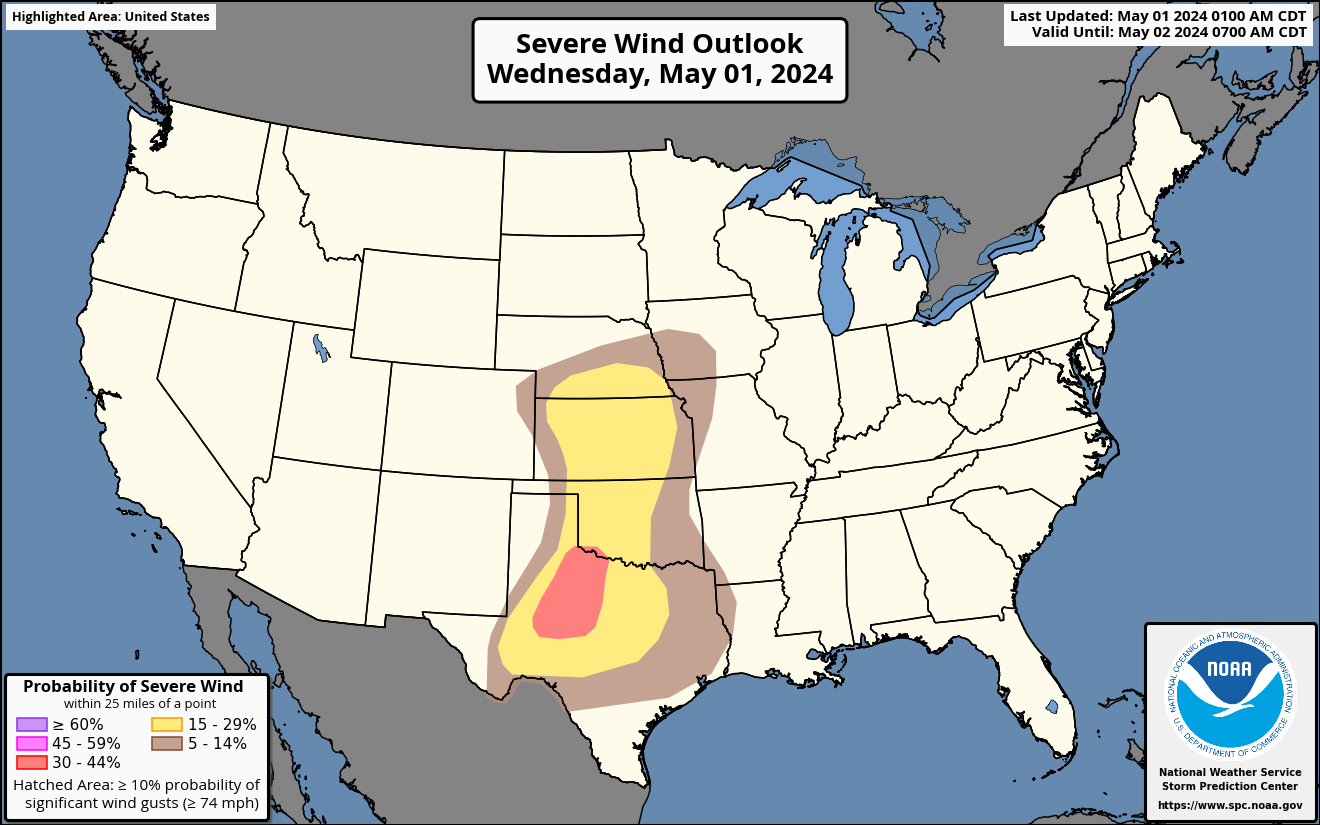
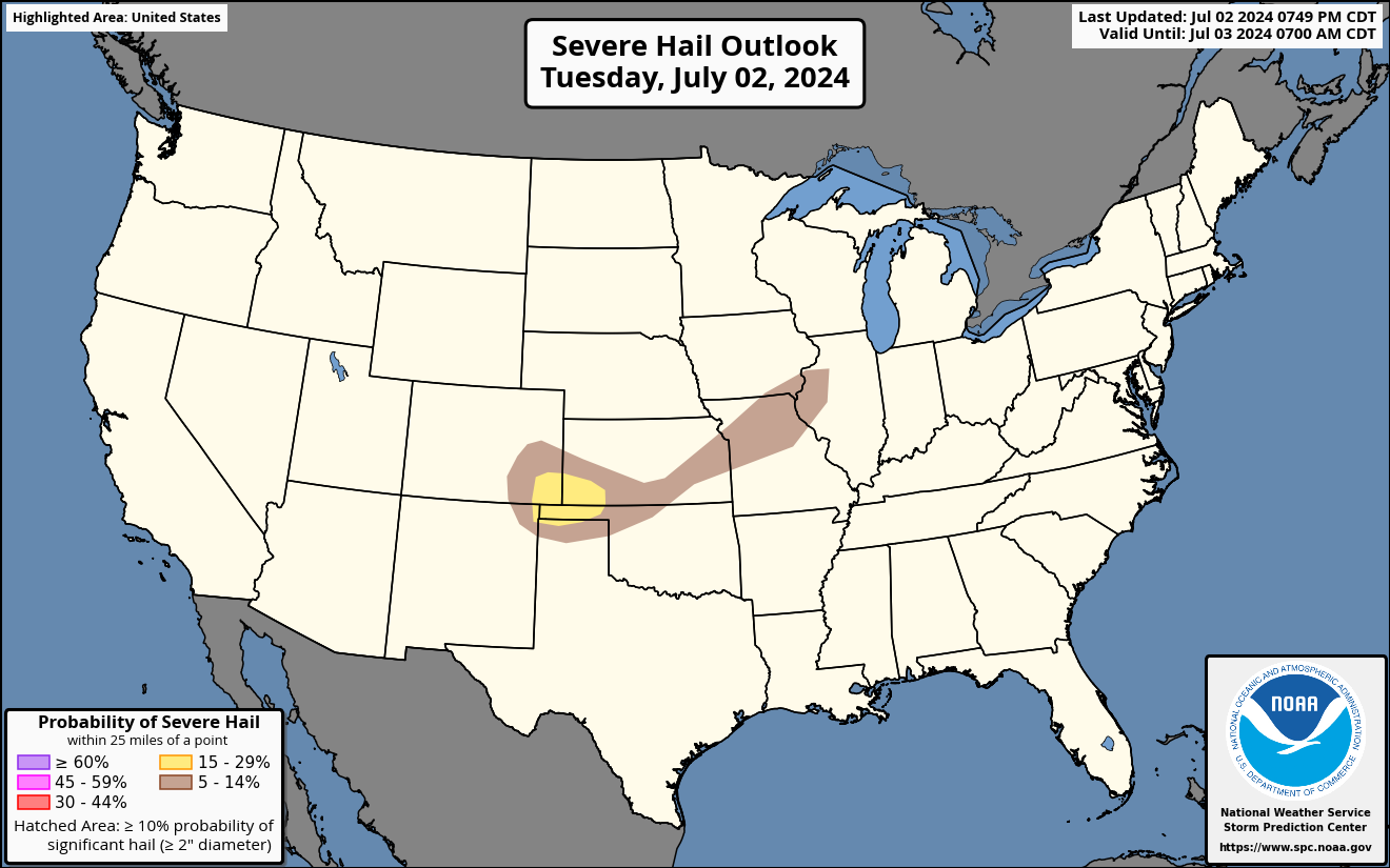
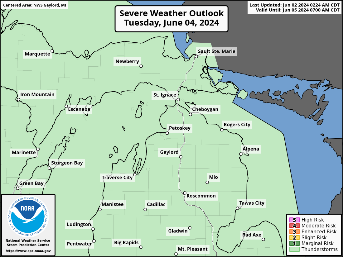
Severe Weather Outlook: Day 1
–Categorical –Tornado –Wind –Hail -United states
–Categorical –Tornado –Wind –Hail -Michigan
–Categorical –Tornado –Wind –Hail -Detroit
–Categorical –Tornado –Wind –Hail -Gaylord
–Categorical –Tornado –Wind –Hail -Grand Rapids
–Categorical –Tornado -Wind –Hail -Marquette
–Categorical –Tornado –Wind –Hail -North Webster
Severe Weather Outlook: Day 2
–Categorical –Tornado –Wind –Hail -United States
–Categorical –Tornado –Wind –Hail -Michigan
–Categorical –Tornado –Wind –Hail -Detroit
–Categorical –Tornado –Wind –Hail -Gaylord
–Categorical –Tornado –Wind –Hail -Grand Rapids
–Categorical –Tornado –Wind –Hail -Marquette
–Categorical –Tornado –Wind –Hail -North Webster
Severe Weather Outlook: Day 3
–Categorical -Probability -United States
–Categorical –Probability -Michigan
–Categorical –Probability -Detroit
–Categorical –Probability -Gaylord
–Categorical –Probability -Grand Rapids
–Categorical –Probability -Marquette
–Categorical –Probability -North Webster
Area Forecast Discussion:
–COD –NWS -Detroit
–COD –NWS -Gaylord
–COD –NWS -Grand Rapids
–COD –NWS -Marquette
–COD –NWS -North Webster
Experimental Graphical Hazardous Weather Outlook:
–Detroit –Gaylord –Grand Rapids –Marquette –North Webster
Hazardous Weather Outlook:
–COD –NWS -Detroit
–COD –NWS -Gaylord
–COD –NWS -Grand Rapids
–COD –NWS -Marquette
–COD –NWS -North Webster
Watches, Warnings or Advisories: Maps: NWS
–Detroit –Gaylord –Grand Rapids –Marquette –North Webster
–Chicago –Green Bay –Milwaukee
–NWS –SPC –Weather Underground -United States
Watches, Warnings or Advisories: By County
NWS Detroit:
–Bay –Genesee –Huron –Lapeer –Lenawee –Livingston –Macomb
–Midland –Monroe –Oakland –Saginaw –Sanilac –Shiawassee
–St. Clair –Tuscola –Washtenaw –Wayne
NWS Gaylord:
–Alcona –Alpena –Antrim –Arenac –Benzie –Charlevoix –Cheboygan
–Chippewa -Crawford –Emmet –Gladwin –Grand Traverse –Iosco
–Kalkaska –Leelanau –Mackinac –Manistee –Missaukee –Montmorency
–Ogemaw –Oscoda –Otsego –Presque Isle –Roscommon –Wexford
NWS Grand Rapids:
–Allegan –Barry –Calhoun –Clare –Clinton –Eaton –Gratiot –Ingham
–Ionia –Isabella –Jackson –Kalamazoo –Kent –Lake –Mason –Mecosta
–Montcalm –Muskegon –Newaygo –Oceana –Osceola –Ottawa –Van Buren
NWS Marquette:
–Alger –Baraga –Delta –Dickinson –Gogebic –Houghton –Iron –Keweenaw
–Luce –Marquette –Menominee –Ontonagon –Schoolcraft
NWS North Webster:
–Berrien –Branch –Cass –Hillsdale –St. Joseph
Air Quality Alert:
–COD –NWS -Detroit
–COD –NWS -Gaylord
–COD –NWS -Grand Rapids
–COD –NWS -Marquette
–COD –NWS -North Webster
Local Storm Reports:
–COD –NWS -Detroit
–COD –NWS -Gaylord
–COD –NWS -Grand Rapids
–COD –NWS -Marquette
–COD –NWS -North Webster
–SPC –SPC2
Non-Precipitation: Warnings/Watches/Advisories
–COD –NWS -Detroit
-COD –NWS -Gaylord
–COD –NWS -Grand Rapids
–COD –NWS -Marquette
–COD –NWS -North Webster
Public Information Statement:
–COD –NWS -Detroit
–COD –NWS -Gaylord
–COD –NWS -Grand Rapids
–COD –NWS -Marquette
–COD –NWS -North Webster
Severe Thunderstorm Warning:
–COD –NWS -Detroit
–COD –NWS -Gaylord
–COD –NWS -Grand Rapids
–COD –NWS -Marquette
–COD –NWS -North Webster
Severe Weather Statement:
–COD –NWS -Detroit
–COD –NWS -Gaylord
–COD –NWS -Grand Rapids
–COD –NWS -Marquette
–COD –NWS -North Webster
Special Marine Warning:
–COD –NWS -Detroit
–COD –NWS -Gaylord
–COD –NWS -Grand Rapids
–COD –NWS -Marquette
–COD –NWS -North Webster
Special Weather Statement:
–COD –NWS -Detroit
–COD –NWS -Gaylord
–COD –NWS -Grand Rapids
–COD –NWS -Marquette
–COD –NWS -North Webster
Storm Reports from the Last 24 Hours:
–Detroit –Gaylord –Grand Rapids –Marquette –North Webster
Tornado Warning:
–COD –NWS -Detroit
–COD –NWS -Gaylord
–COD –NWS -Grand Rapids
–COD –NWS -Marquette
–COD –NWS -North Webster
Watch County Notification:
–COD –NWS -Detroit
–COD –NWS -Gaylord
–COD –NWS -Grand Rapids
–COD –NWS -Marquette
–COD –NWS -North Webster
Winter Weather: Warnings/Watches/Advisories
–COD –NWS -Detroit
–COD –NWS -Gaylord
–COD –NWS -Grand Rapids
–COD –NWS -Marquette
–COD –NWS -North Webster
–COD –NWS -Chicago
–COD –NWS -Green Bay
–COD –NWS –Milwaukee
–mPING
AGRICULTURE
Crop Weather:
–Michigan –Illinois –Indiana –Iowa –Kansas –Minnesota
–Nebraska –Ohio –South Dakota –Wisconsin
–Weekly Crop & Weather Bulletin
Drought Monitor:
–United States –Great Lakes –Michigan
–U.S. Drought Monitor
–US Monthly Drought Outlook
–US Seasonal Drought Outlook
Michigan State University:
–Agricultural Weather Office
–Enviroweather
Other:
–Evaporation –Precipitation –Runoff –Soil Moisture –Temperature
–Recent Anomalies
–Agricultural Weather Highlights
AVIATION
Aviation Weather Center:
–Aviation Weather Center –Facebook –Twitter
Center Weather Service Units:
–Chicago –Cleveland –Minneapolis
Aviation Weather Center: METAR
–Alma –Battle Creek –Benton Harbor –Big Rapids –Cadillac
–Charlotte –Coldwater –Fremont –Grand Rapids –Hillsdale
–Holland –Ionia –Jackson –Kalamazoo –Lansing –Ludington
–Marshall –Mason –Mount Pleasant –Muskegon –South Bend
–South Haven –Sturgis –Three Rivers
Terminal Aerodrome Forecast:
–Battle Creek –Grand Rapids –Jackson –Kalamazoo
–Lansing –Manistee –Muskegon –South Bend
–Chicago Midway –Chicago O’Hare –Detroit
CLIMATE
Annual Climatological Report:
-COD –NWS -Grand Rapids
-COD –NWS -Holland
-COD –NWS -Muskegon
COCORAHS Precipitation Summary:
–COD –NWS -Grand Rapids
–COD –NWS -North Webster
Daily Climate Summary:
–COD –NWS -Grand Rapids
–COD –NWS -Holland
–COD –NWS -Muskegon
Midwest Climate Watch:
–Purdue University
Monthly Climatological Report:
-COD –NWS -Grand Rapids
-COD –NWS -Holland
-COD –NWS -Muskegon
National High & Low Temperatures:
–WPC
Preliminary Local Climatological Data:
–Grand Rapids –Holland –Muskegon
Record Event Report:
–COD –NWS -Detroit
–COD –NWS -Gaylord
–COD –NWS -Grand Rapids
–COD –NWS -Marquette
–COD –NWS -North Webster
Regional Max/Min & Precipitation Table:
–COD –NWS -Detroit
–COD –NWS -Gaylord
–COD –NWS -Grand Rapids
–COD –NWS -Marquette
–COD –NWS -North Webster
Seasonal Climatological Report:
-COD –NWS -Grand Rapids
-COD –NWS -Holland
-COD –NWS -Muskegon
Storm Data:
–NCDC Storm Events –Michigan –Storm Data –Storm Prediction Center
CURRENT WEATHER
Current Weather: Air Sports Net: Michigan
–Apparent Temperature –Barometric Pressure
–Cloud Cover –Current Weather –Dewpoint –Flight Rules
–Heat Index –ICAO Codes –Relative Humidity –Temperature
–Timestamp –Visibility –Wind Chill –Wind Direction
–Wind Gust –Wind Speed
Current Weather:
–Grand Rapids -Holland –Muskegon
–East Town Columbus –Grand Haven Airport
Hourly Weather Roundup:
–COD –NWS -Michigan
–COD –NWS -Illinois
–COD –NWS -Indiana
–COD –NWS -Ohio
–COD –NWS -Wisconsin
MesoWest:
–Grand Rapids –Holland –Muskegon
METARS:
–Grand Rapids –Holland –Muskegon
Station Plots: College of Du Page
–Michigan –Illinois –Indiana –Ohio –Wisconsin –United States
3-Day History:
–Grand Rapids –Holland –Muskegon
Other:
–MADIS
FIRE WEATHER
NWS Fire Weather:
–NWS
Fire Information Resource Management System US/Canada:
–FIRMS
Fire Weather Outlook: SPC
–Day 1 –Day 2 –Day3-8
Fire Weather Forecast:
–COD –NWS -Detroit
–COD –NWS -Gaylord
–COD –NWS -Grand Rapids
–COD –NWS -Marquette
–COD –NWS -North Webster
Fire Weather:
–Detroit –Gaylord –Grand Rapids –Marquette –North Webster
Michigan DNR Wildland Fire:
–DNR
Red Flag Warning:
-COD -NWS -Detroit
–COD –NWS -Gaylord
–COD –NWS -Grand Rapids
-COD -NWS -Marquette
-COD –NWS -North Webster
Canadian Interagency Forest Fire Centre:
–CIFFC
Eastern Area Coordination Center:
–EACC
Geographic Area Coordination Center:
–GACC
Great Lakes Fire & Fuels:
–GLFF
Weather Near Fires:
–MesoWest
Wildfire Assessment Center:
–WFAS
–NWS Fire Weather
–SPC Fire Weather Outlooks
FORECASTS
Forecast by Counties:
NWS Detroit:
–Bay –Genesee –Huron –Lapeer –Lenawee –Livingston –Macomb
–Midland –Monroe –Oakland –Saginaw –Sanilac –Shiawassee
–St. Clair –Tuscola –Washtenaw –Wayne
NWS Gaylord:
–Alcona –Alpena –Antrim –Arenac –Benzie –Charlevoix –Cheboygan
–Chippewa Central –Chippewa Southeast –Chippewa Western
–Crawford –Emmet –Gladwin –Grand Traverse –Iosco –Kalkaska
–Leelanau –Mackinac Eastern –Mackinac Western –Manistee
–Missaukee –Montmorency–Ogemaw –Oscoda –Otsego –Presque Isle
–Roscommon –Wexford –Beaver Island –Mackinac Island/Bois Blanc Island
NWS Grand Rapids:
–Allegan –Barry –Calhoun –Clare –Clinton –Eaton –Gratiot -Ingham
–Ionia –Isabella –Jackson –Kalamazoo –Kent –Lake –Mason –Mecosta
–Montcalm –Muskegon –Newaygo –Oceana –Osceola –Ottawa –Van Buren
NWS Marquette:
–Alger –Baraga –Delta –Dickinson –Gogebic –Houghton –Houghton Southern
–Iron –Keweenaw–Luce –Marquette –Menominee –Ontonagon
–Schoolcraft Northern –Schoolcraft Southern
NWS North Webster:
-Berrien –Branch –Cass –Hillsdale –St. Joseph
FORECASTS
Area Forecast Discussions:
–COD –NWS -Detroit
–COD –NWS -Gaylord
–COD –NWS -Grand Rapids
–COD –NWS -Marquette
–COD –NWS -North Webster
–COD –NWS -Chicago
–COD –NWS -Green Bay
–COD –NWS -Milwaukee
–AFD Picker –2
Area Forecast Matrices:
–COD –NWS -Grand Rapids
–COD –NWS -North Webster
BUFKIT:
-Iowa State –Penn State
Excessive Rainfall Forecasts:
–Interactive –WPC
Forecast Cities: Grand Haven:
–AccuWeather –NWS –WeatherBug –Weather Underground
Forecast Cities: NWS Grand Haven Area:
–Grand Haven –Grand Haven Offshore –Grand Haven State Park
–Allendale –Coopersville –Ferrysburg –Fruitport
–Norton Shores –Nunica –Spring Lake –West Olive
–Grand Rapids –Holland –Muskegon
Forecast Meteogram Generator:
–Grand Rapids –Muskegon
Forecast Models:
–College of Du Page –Pivotal Weather –WeatherBELL –Weathermodels
–CMU Dr. Baxter Mapwall
–CMU Midwest Mesoanalysis
–CMU Model Viewer
–CMU Weather Mapwall
NSSL:
–HRRR –MPAS-HN-NSSL –MPAS-HT-NSSL –MPAS-RT-NSSL
–RRFS-EMC –WRF-NSSL 1KM –WRF-NSSL –WoFS
SPC:
–SPC HREF –SPC HRRR –SPC SREF Plumes –SPC SREF
–SUNY Albany
Forecast Surface Charts: WPC
–Day 1/2-2 1/2 –Day 3-7 -Legacy Page
-Day 1/2-2 1/2 –Day 3-7
Hourly & Tabular Forecast:
–Grand Haven –Grand Haven 2 -Hourly
–Grand Haven –Grand Haven 2 -Tabular
IDSS Forecast Points:
–Grand Haven –Grand Rapids -Holland –Muskegon
Long-Range Forecasts:
–6 to 10 Day Outlooks
–8 to 14 Day Outlooks
–Week 3-4 Outlooks –Official 30-Day Forecasts
–Climate Prediction Center
–Blocking –ENSO –MJO
–Recent Anomalies –Teleconnections
Mesoscale Precipitation Discussions:
–WPC
NBM ID Viewer:
–Alma –Battle Creek –Big Rapids –Charlotte –Fremont
–Grand Rapids –Holland –Ionia –Jackson –Kalamazoo
–Lansing –Ludington –Marshall –Mason –Mount Pleasant
–Muskegon –South Haven
NDFD GIS Graphics:
–Grand Rapids –North Webster –Home
–Chicago –Detroit –Gaylord –Green Bay –Marquette –Milwaukee
NDFD Graphical Forecast:
–Grand Rapids –North Webster
Point Forecast Matrices:
–COD –NWS -Detroit
–COD –NWS -Gaylord
–COD –NWS -Grand Rapids
–COD –NWS -Marquette
–COD –NWS -North Webster
Quantitative Precipitation Forecasts:
–Legacy Page –WPC
Tabular State Forecast:
–COD –NWS -Michigan
–COD –NWS -Illinois
–COD –NWS -Indiana
–COD –NWS -Ohio
–COD –NWS -Wisconsin
TV Stations Forecast:
–WOOD-TV –WOOD-TV2 –WWMT –WXMI –WZZM
Weather Prediction Center Discussions:
–COD –WPC -Short Range Forecast Discussion
–COD –WPC -Extended Forecast Discussion
–COD -WPC -Hazards Outlook
–COD –WPC -Excessive Rainfall Discussion
–COD –WPC -Heavy Snow & Icing Discussion
–COD –WPC -Mesoscale Precipitation Discussions
Zone Forecasts:
–COD –NWS -Detroit
–COD –NWS -Gaylord
–COD –NWS -Grand Rapids
–COD –NWS -Marquette
–COD –NWS -North Webster
Courtesy: Climate Prediction Center, College of Du Page, National Weather Service
HYDROLGY:
Advanced Hydrologic Prediction Service:
–Detroit –Gaylord —Grand Rapids –Marquette –North Webster
Flash Flood Statement:
–COD –NWS -Detroit
–COD –NWS -Gaylord
–COD –NWS -Grand Rapids
–COD –NWS -Marquette
–COD –NWS -North Webster
Flash Flood Warning:
-COD –NWS -Detroit
-COD –NWS -Gaylord
–COD –NWS -Grand Rapids
-COD –NWS -Marquette
–COD –NWS -North Webster
Flash Flood Watch:
-COD –NWS -Detroit
-COD –NWS -Gaylord
–COD –NWS -Grand Rapids
-COD –NWS -Marquette
–COD –NWS -North Webster
Flood Statement:
-COD –NWS -Detroit
-COD –NWS -Gaylord
–COD –NWS-Grand Rapids
-COD –NWS -Marquette
–COD –NWS -North Webster
Flood Warning:
-COD –NWS -Detroit
-COD –NWS -Gaylord
–COD –NWS -Grand Rapids
-COD –NWS -Marquette
–COD –NWS -North Webster
Flood Watch:
-COD -NWS -Detroit
-COD -NWS -Gaylord
–COD -NWS -Grand Rapids
-COD -NWS -Marquette
–COD -NWS -North Webster
Hydrologic Summary:
–COD –NWS -Detroit
–COD -NWS -Gaylord
–COD –NWS -Grand Rapids
–COD –NWS -Marquette
–COD –NWS -North Webster
Mesoscale Precipitation Discussions:
–WPC
River Forecast Center:
–North Central River Forecast Center
Significant River Flood Outlook:
–WPC
MARINE WEATHER
Great Lakes Portal:
–NWS
Special Marine Warning:
–COD –NWS -Detroit
–COD –NWS -Gaylord
–COD –NWS -Grand Rapids
–COD –NWS -Marquette
–COD –NWS -North Webster
-COD -NWS -Chicago
-COD -NWS -Green Bay
-COD -NWS -Milwaukee
Marine Weather Message:
–COD –NWS -Detroit
–COD –NWS -Gaylord
–COD –NWS -Grand Rapids
–COD –NWS -Marquette
–COD –NWS -North Webster
Marine Weather Statement:
–COD –NWS -Detroit
–COD –NWS -Gaylord
–COD –NWS -Grand Rapids
–COD –NWS -Marquette
–COD –NWS -North Webster
Coastal Hazard Message:
–COD –NWS -Detroit
–COD –NWS -Gaylord
–COD –NWS -Grand Rapids
–COD –NWS -Marquette
–COD –NWS -North Webster
Great Lakes Beach Hazards:
–NWS
FORECASTS
Area Forecast Discussion:
–COD –NWS -Detroit
–COD –NWS -Gaylord
–COD –NWS -Grand Rapids
–COD –NWS -Marquette
–COD –NWS -North Webster
EMC Operational Wave Models:
–NCEP
Experimental Beach Forecast Homepage:
–Detroit –Gaylord –Grand Rapids –Marquette –North Webster
Great Lakes Environmental Research Laboratory:
–Great Lakes Coastal Forecast System
Nearshore Marine Forecast:
–COD –NWS -Detroit
–COD –NWS -Gaylord
–COD –NWS -Grand Rapids
–COD –NWS -Marquette
–COD –NWS -North Webster
Nearshore Marine Tabular Forecast: Experimental
–Detroit –Gaylord –Grand Rapids –Marquette –North Webster
NWS Marine Weather Forecasts:
–NWS
Open Lake Forecast:
–COD –NWS -Lake Erie
–COD –NWS -Lake Huron
–COD –NWS -Lake Michigan
–COD –NWS -Lake St. Clair
–COD –NWS -Lake Superior
Open Lake Tabular Forecast: Experimental
–Lake Erie
–Lake Huron
–Lake Michigan
–Lake Superior
Operational Forecast System: NOAA
–Lake Erie
–Lake Huron/Michigan
–Lake Superior
Surf Forecast:
–COD –NWS -Detroit
–COD –NWS -Gaylord
–COD –NWS -Grand Rapids
–COD –NWS -Marquette
–COD –NWS -North Webster
WaveWatch III Graphics:
–GLERL
ICE
Great Lakes Ice Charts:
–USICE
Great Lakes Ice Outlooks & Summary:
–USICE
Great Lakes Ice Products:
–NWS
OBSERVATIONS
Great Lakes Meteorological Real-Time Coastal Observation Network (ReCON)
NOAA Great Lakes Environmental Research Laboratory
Great Lakes Observations:
–NWS
NDBC/Great Lakes:
–NBDC –United States
NOAAPORT – Realtime Great Lakes Weather Data and Marine Observations
–GLERL
nowCOAST:
–NOAA
Observations: Lake Michigan
–Big Sable Point
–Burns Harbor
–Fairport
–Grand Traverse Light
–Holland
–Holland Buoy
–Ludington
–Manistee Harbor
–Michigan City Buoy
–Michigan City Light
–Muskegon Buoy
–Muskegon Coast Guard
-Naubinway
–North Lake Michigan Buoy
–Port Inland
–South Haven Buoy
–South Haven Light
–South Lake Michigan Buoy
–St. Joseph
–White Shoal Light
Water Temperatures:
–COD –NWS -Gaylord
–COD –NWS -Grand Rapids
–COD –NWS -North Webster
–COASTWATCH
OTHER
Marine Traffic:
–Grand Haven –Lake Michigan
Webcams:
–Grand Haven –Draw Bridge
–WGHN Beach Cam –WGHN Channel Cam
GLERL
RADAR
Lightning: GLM Flash Density
–Great Lakes –Northern Rockies –Southeast –Southern Mississippi Valley
–Southern Plains –Southern Rockies –Upper Mississippi Valley
–Canada/Northern US –Carribean –Gulf of Mexico –United States
Radar Images:
–ACCU –COD –NWS -Detroit
–ACCU –COD –NWS -Gaylord
–ACCU –COD –NWS -Grand Rapids
–ACCU –COD –NWS -Marquette
–ACCU –COD –NWS -North Webster
Radar Images: AccuWeather
–Grand Rapids –North Webster
–Chicago –Detroit –Gaylord –Green Bay –Marquette –Milwaukee
Radar Images: Aviation Weather Center
–Detroit –Albuquerque –Austin –Baltimore –Cody –Denver –Evansville
–Little Rock –Minneapolis –Montgomery –Pierre –Tampa –Wichita
Radar Images: Baron
–Live Weather
Radar Images: College of Du Page
–Grand Rapids –North Webster
–Chicago –Detroit –Gaylord –Green Bay –Marquette –Milwaukee
–Michigan –Lower Michigan –Northern/Upper Peninsula
–Corn Belt –Midwest –Midwest 2 –Northeast –Southeast –Southern Plains
–United States
Radar Image: MRMS
–MRMS
Radar Images: National Weather Service
–Grand Rapids –North Webster
–Chicago –Detroit –Gaylord –Green Bay –Marquette –Milwaukee
Radar Other:
–Ventusky –Windy.com
Radar Images: Plymouth State University:
–Grand Rapids –North Webster –Midwest —Midwest Radar/Satellite
Radar Images: University of Wisconsin
–Midwest –Centered on Wisconsin
VWP Hodographs:
–VWP Hodographs
WSR-88D Radar Outage Notification:
–COD –NWS -Grand Rapids
–COD –NWS -North Webster
WSR-88D VAD Hodograph:
–Grand Rapids
SATELLITE
Satellite Images: College of Du Page
–Michigan –Great Lakes –United States –NA -Longwave IR
–Michigan –Great Lakes –United States -NA -Sandwich RGB
–Michigan –Great Lakes –United States –NA -Shortwave IR
–Michigan –Great Lakes –United States –NA -Visible
–Michigan –Great Lakes –United States –NA -Water Vapor
Satellite Images: MSFC
–Visible –Short-Wave IR –Long-Wave IR –Water Vapor -Midwest
Satellite Images: NESDIS
–Great Lakes –United States -GeoColor
–Great Lakes –United States -GLM Flash Extent Density
–Great Lakes –United States -Longwave IR
–Great Lakes –United States -Sandwich RGB
–Great Lakes –United States -Shortwave IR
–Great Lakes –United States -Visible
–Great Lakes –United States -Water Vapor
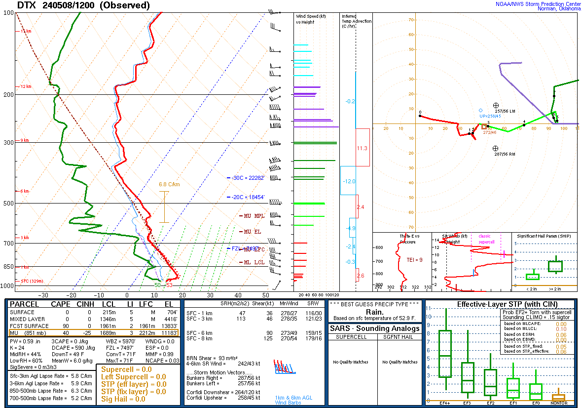
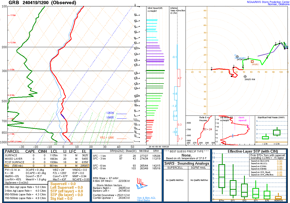
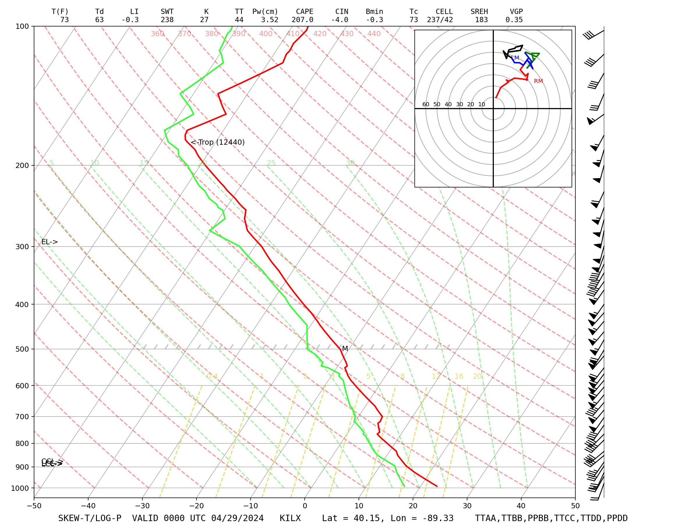
SOUNDINGS
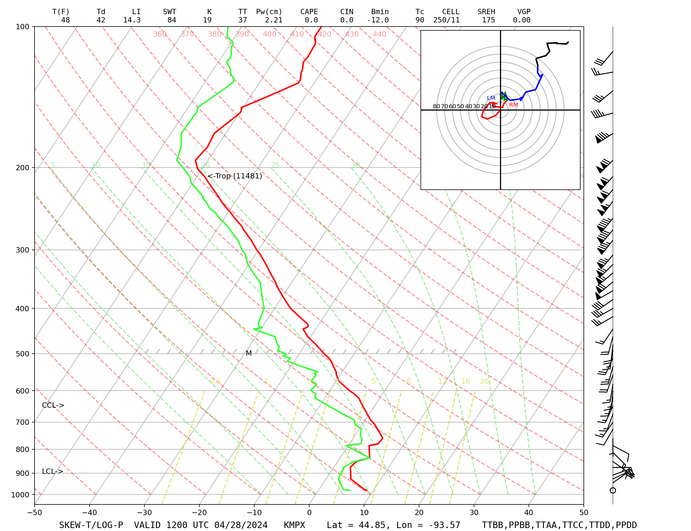
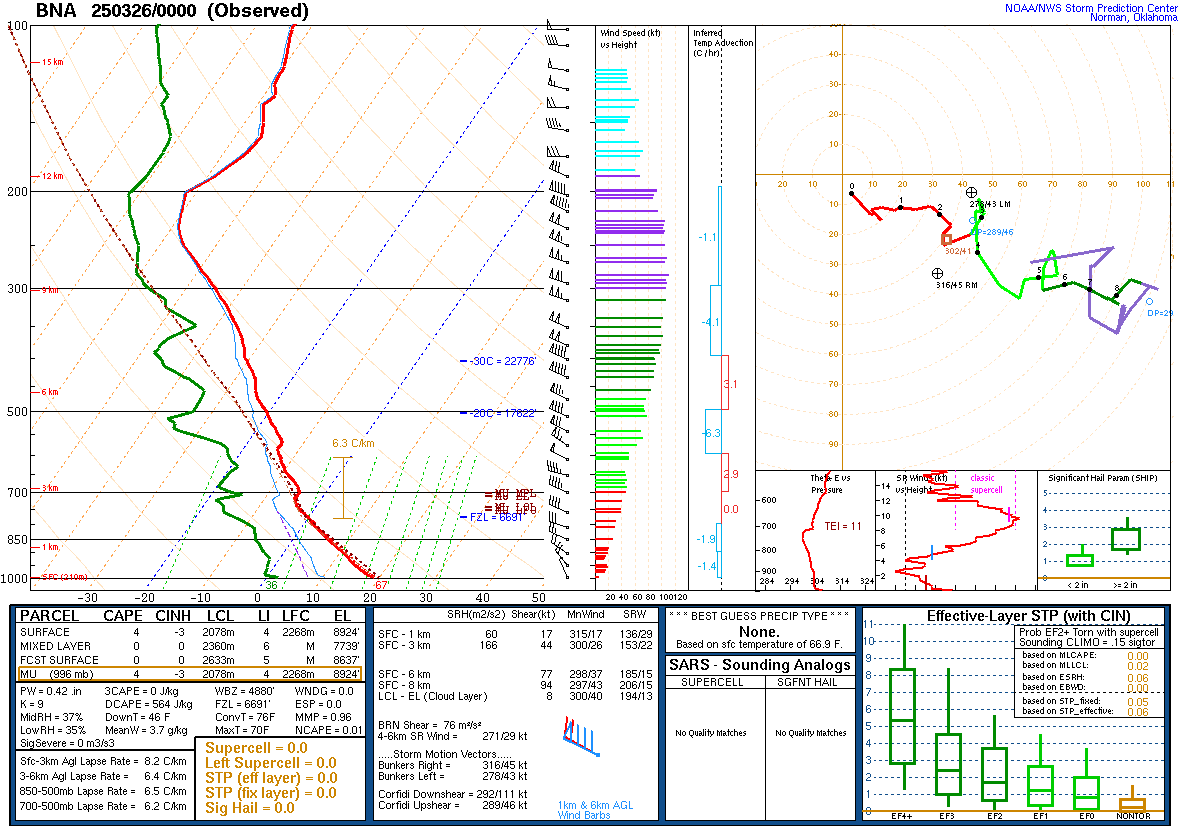
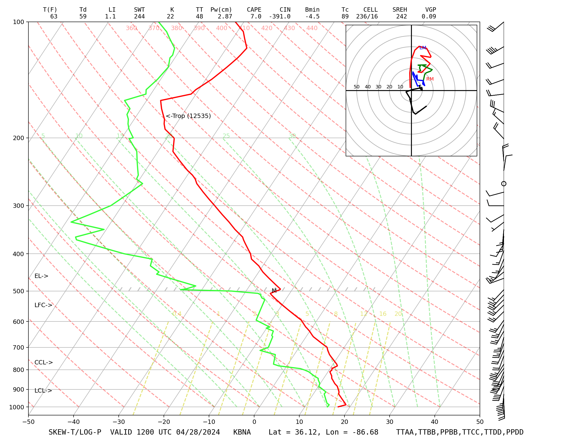
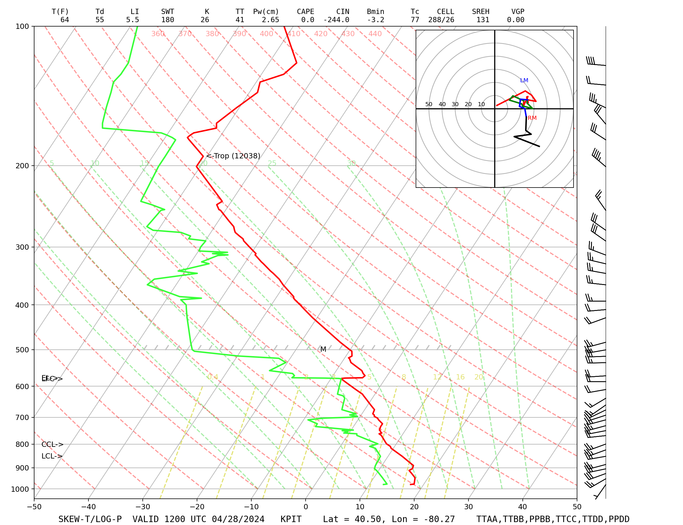
Soundings:
–COD –COD2 –Hodo –Text –SPC –UCAR -Buffalo
–COD –COD2 –Hodo –Text –SPC –UCAR -Davenport
–COD –COD2 –Hodo –Text –SPC –UCAR -Detroit
–COD –COD2 –Hodo –Text –SPC –UCAR -Gaylord
–COD –COD2 –Hodo –Text –SPC –UCAR -Green Bay
–COD –COD2 –Hodo –Text –SPC –UCAR -International Falls
–COD –COD2 –Hodo –Text –SPC –UCAR -Lincoln
–COD –COD2 –Hodo –Text –SPC –UCAR -Minneapolis
–COD –COD2 –Hodo –Text –SPC –UCAR -Nashville
–COD –COD2 –Hodo –Text –SPC –UCAR -Pittsburgh
–COD –COD2 –Hodo –Text –SPC –UCAR -Wilmington
Aircraft Skew-T and Text Data:
–MADIS
STATION PLOTS
Station Plots: Air Sports Net
–Michigan –Illinois –Indiana –Iowa –Kansas –Minnesota –Missouri
–Nebraska –North Dakota –Ohio –South Dakota –Wisconsin
–Colorado –Florida –New Mexico –Oklahoma –Texas –Wyoming
–Michigan –Apparent Temperature –Barometric Pressure
–Cloud Cover –Current weather –Dewpoint –Flight Rules
–Heat Index –ICAO Codes –Relative Humidity –Temperature
–Timestamp –Visibility –Wind Chill –Wind Direction
–Wind Gust –Wind Speed
Station Plots: College of Du Page
–Michigan –Illinois –Indiana –Ohio –Wisconsin –United States
Station Plots: Storm Prediction Center PDF
–Apalachicola –Beckley –Billings –Buffalo –Central Oklahoma
–Columbia –Evanston –Fargo –Flippin –Grants –Junction
–Lafayette –Medicine Lodge –Milwaukee –Oklahoma City
–Paducah –Omaha –Steamboat Springs
Station Plots: UCAR
–Detroit –Albuquerque –Austin –Denver –Des Moines –Evansville
–Minneapolis –Montgomery –Pierre –Tampa –Wichita
SURFACE
Surface Charts: College of Du Page
–Midwest –United States -Frontal Analysis
–Moisture Convergence –Pressure Falls –Temperature/SLP –Theta-E -Midwest
–Moisture Convergence –Pressure Falls –Temperature/SLP –Theta-E -USA
–Raw Plots
Surface Charts: Mesonet
–Temperature –Dew Point –Heat Index/Wind Chill
–Wind Speed –Altimeter Setting
Surface Charts 12Z & 00Z: Ocean Prediction Center
–Unified Surface Analysis –3 Day Loop -United States
–Unified Surface Analysis –3-Day Loop -East
–Unified Surface Analysis –3 Day Loop -Midwest
–Unified Surface Analysis –3 Day Loop -South
–Unified Surface Analysis –3-Day Loop -West
–Unified Surface Analysis –3 Day Loop -Canada
–Unified Surface Analysis –3 Day Loop -Atlantic Ocean
–Unified Surface Analysis –3 Day Loop -Gulf of Mexico
–Unified Surface Analysis –3 Day Loop -Pacific Ocean
Surface Charts: UCAR
–Temperature –Dew Point –Theta-E –Winds/MSLP –4-Panel
Surface Charts: Weather Prediction Center
–North America Fronts/MSLP –Loop
–North America Surface Analysis
–United States urface Analysis –Zoom-In
–United States Analysis/Radar –Loop
–United States Analysis/Satellite –Loop
–United States Fronts/SLP –Loop
–United States/Southern Canada
–Central US (Central) –Loop
–Central US (South) –Loop
–Florida –Loop
–Midwest –Loop
TROPICS
National Hurricane Center:
–Facebook –IEM –Twitter –Home Page
NWS Southern Region Tropical Webpage:
–NWS
Tropical Tidbits:
–TT
UPPER AIR
Isentropic Charts:
–COD
Upper Air Charts: College of Du Page
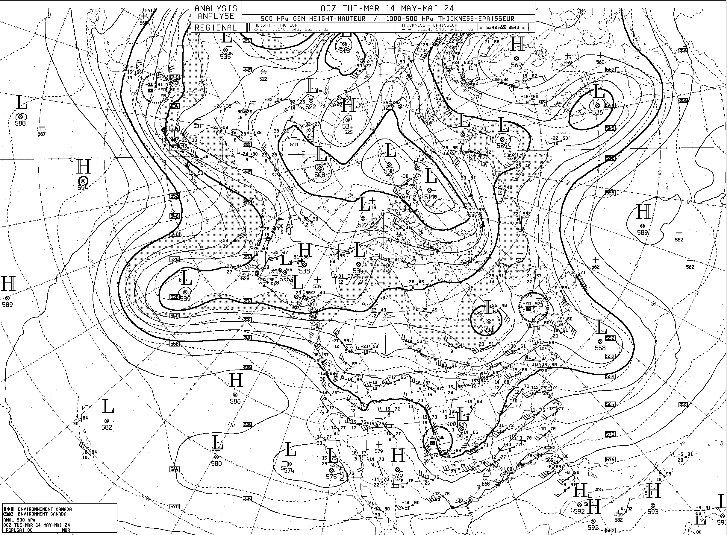
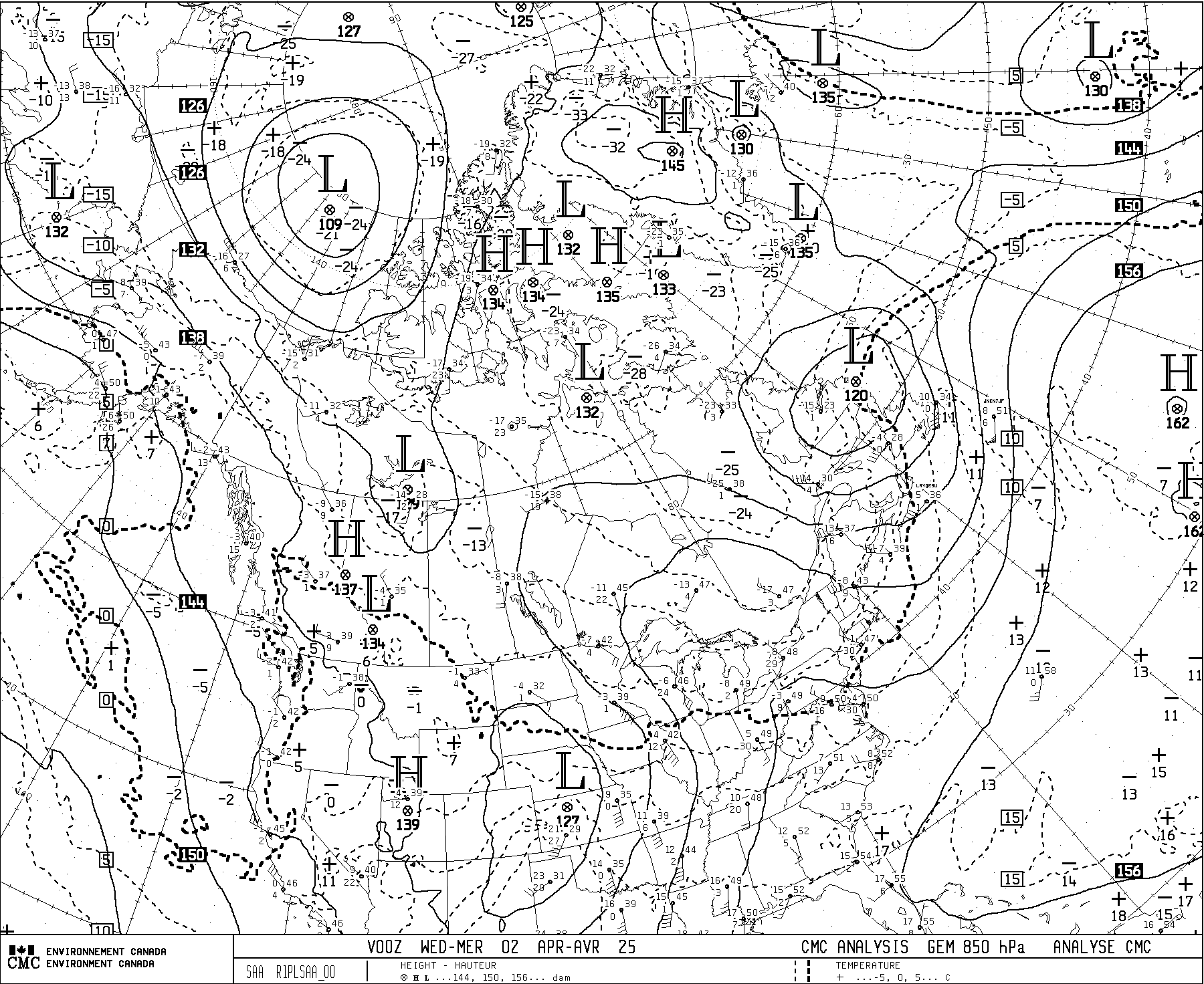
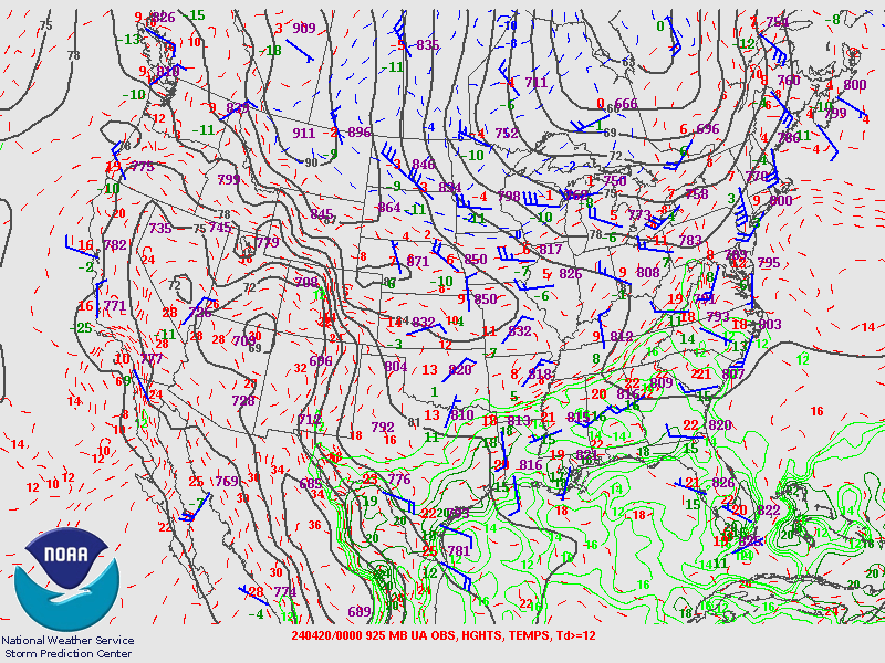
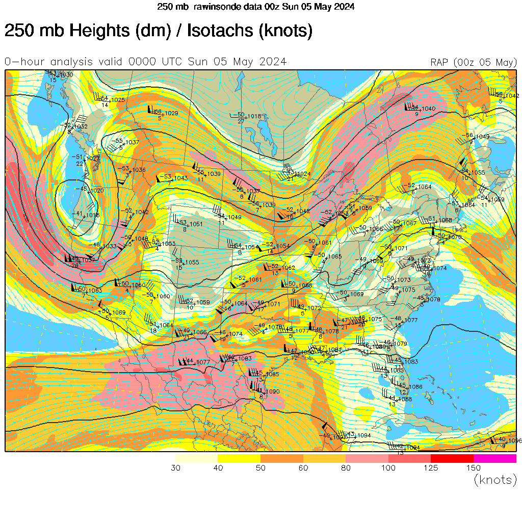
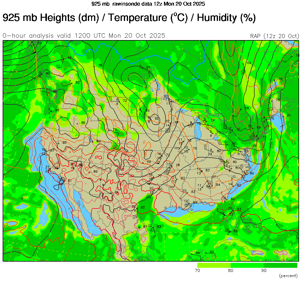
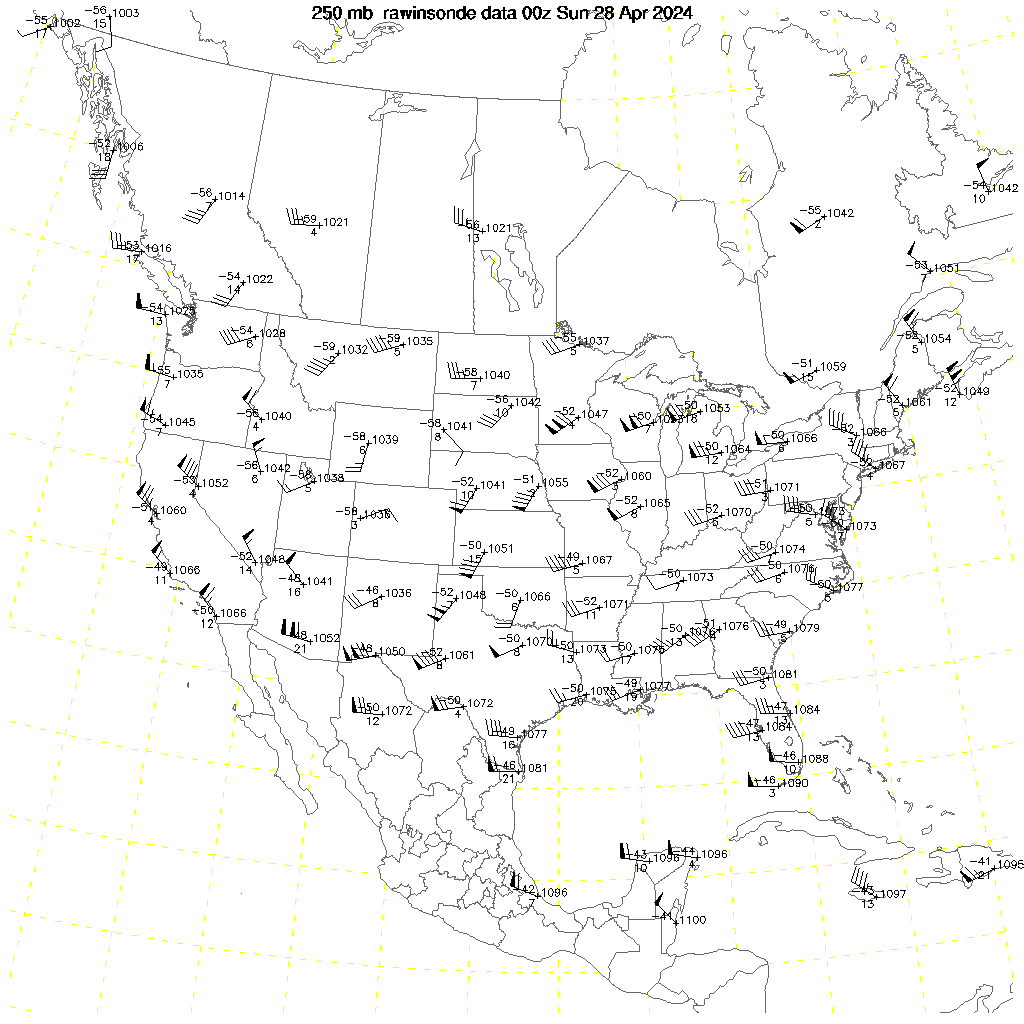
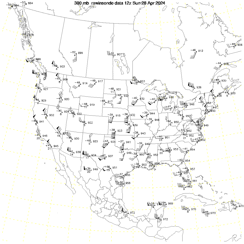
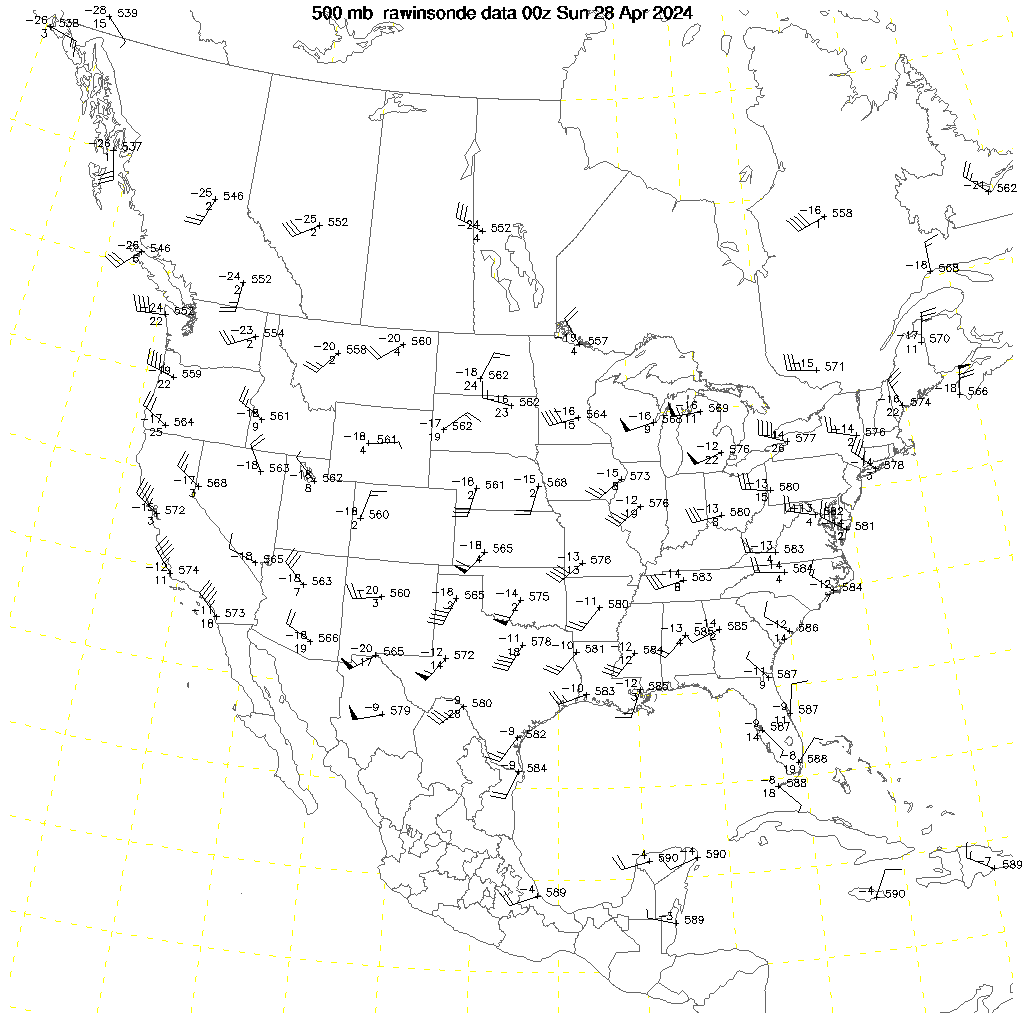
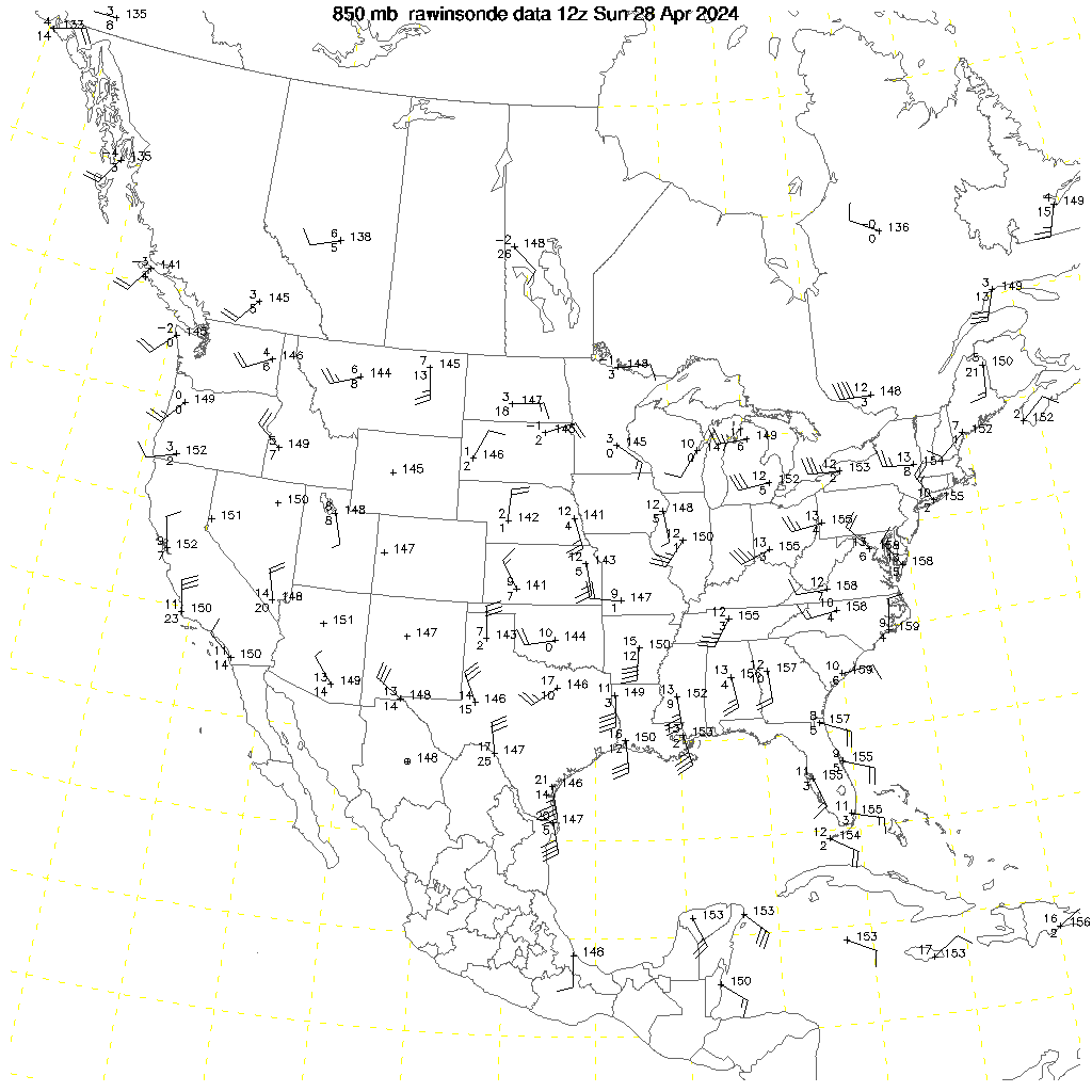
–250 mb –300 mb –500 mb –700 mb –850 mb
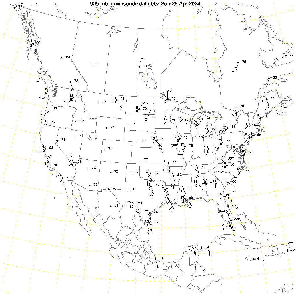
–250 mb –300 mb –500 mb –700 mb –850 mb –925 mb PDF
–250 mb –300 mb –500 mb –700 mb –850 mb –925 mb Raw
–Upper Air Data
–500mb 12-Hour Height Change –500mb Vorticity
–700mb Relative Humidity
–850mb Dewpoint –850mb Theta-E
–700-500mb Delta-T
–0-500m ML CAPE
–Sfc-400mb Bulk Shear
–Precipitable Water/SFC-400mb Mean Wind
Upper Air Charts: Environment Canada
–250 mb –500 mb –700 mb –850 mb
Upper Air Charts: Penn State University
–300 mb –500 mb –700 mb –850 mb
Upper Air Charts: Plymouth State University
–250 mb –300 mb –500 mb –700 mb –850 mb –925 mb
–Plymouth State University
Upper Air Charts: Storm Prediction Center
–250 mb –300 mb –500 mb –700 mb –850 mb –925 mb -12Z
–250 mb –300 mb –500 mb –700 mb –850 mb –925 mb -00Z
–250 mb –300 mb –500 mb –700 mb –850 mb –925 mb –Sfc -12Z PDF
–250 mb –300 mb –500 mb –700 mb –850 mb –925 mb –Sfc -00Z PDF
Upper Air Charts: UCAR
–250 mb –300 mb –500 mb –700 mb –850 mb –925 mb
–250 mb –300 mb –500 mb –700 mb –850 mb –925 mb Plot
Upper Air Charts: University of Wyoming
–UWY
WINTER
National Weather Service: Weather Forecast Offices
–Detroit –Gaylord –Grand Rapids –Marquette –North Webster
Watches, Warnings and Advisories:
–Michigan –Illinois –Indiana –Ohio –United States –Wisconsin
Winter Weather Warnings/Watches/Advisories:
–COD –NWS -Grand Rapids
–COD –NWS -North Webster
–COD –NWS -Chicago
–COD –NWS -Detroit
–COD –NWS -Gaylord
–COD –NWS -Green Bay
–COD –NWS -Marquette
–COD –NWS –Milwaukee
Area Forecast Discussion:
–COD –NWS -Grand Rapids
–COD –NWS -North Webster
–COD –NWS -Detroit
–COD –NWS -Gaylord
–COD –NWS -North Webster
Composite Charts:
–WPC
Day 4-7 Outlook:
–WPC
Forecast Surface Low Tracks:
–WPC –WPC2
Freezing Rain Probability Forecasts:
–WPC
Heavy Snow & Icing Discussion:
–COD –WPC
Local Storm Reports:
–COD –NWS -Grand Rapids
–COD –NWS -North Webster
–COD –NWS -Detroit
–COD –NWS -Gaylord
–COD –NWS -Marquette
National Gridded Snowfall Analysis:
–NOHRSC
National Snow Analysis:
–NOHRSC
NDFD Graphical Forecasts: Ice Amount
–United States
NDFD Graphical Forecasts: Snow Amount
–United States
NDFD Graphical Forecast: Snow Amount
–6hr –12hr –18hr –24hr –30hr –36hr –42hr –48hr -Grand Rapids
–6hr –12hr –18hr –24hr –30hr –36hr –42hr –48hr -North Webster
–6hr –12hr –18hr –24hr –30hr –36hr –42hr –48hr -Detroit
–6hr –12hr –18hr –24hr –30hr –36hr –42hr –48hr -Gaylord
–6hr –12hr –18hr –24hr –30hr –36hr –42hr –48hr -Marquette
Probabilistic Snowfall Experiment:
–Grand Rapids –North Webster
–Chicago –Detroit –Gaylord –Green Bay –Marquette –Milwaukee
Probabilistic Snowfall Forecasts:
Probability of Near-Surface Temperatures at or below 32F
–WPC
Probabilistic Winter Precipitation Guidance:
–WPC
Road Conditions:
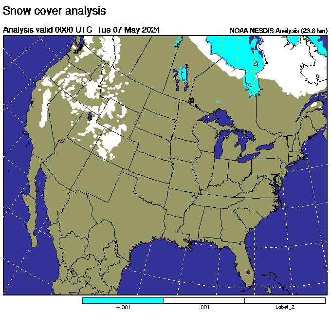
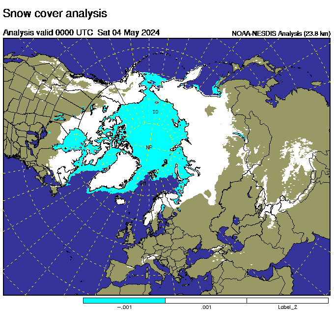
Snow Cover:
–NOHRFC –NSA –UCAR –UCAR2 –Weather Underground
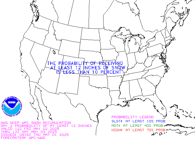
Snowfall Probability Forecasts:
–Day 1 –Day 2 –Day 3 -4 inches or more
–Day 1 –Day 2 –Day 3 -8 inches or more
–Day 1 –Day 2 –Day 3 -12 inches or more
–United States
Snowfall Reports from the Last 24 Hours:
–Grand Rapids –North Webster
–Chicago –Detroit –Gaylord –Green Bay –Marquette –Milwaukee
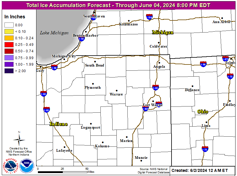
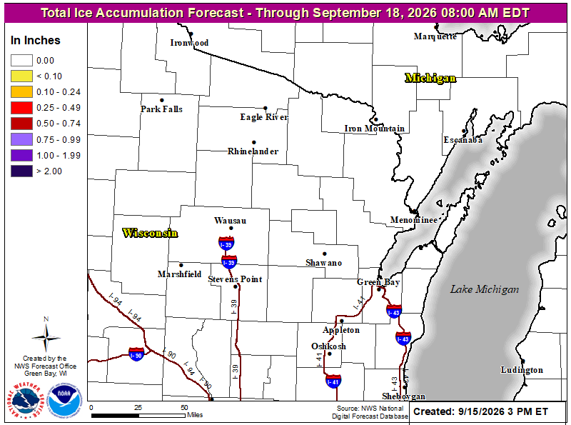
Total Ice Accumulation Forecast:
–Grand Rapids –North Webster –United States
–Chicago –Detroit –Gaylord –Green Bay –Marquette –Milwaukee
Total Snow Forecast:
–Grand Rapids –North Webster –United States
–Chicago –Detroit –Gaylord –Green Bay –Marquette –Milwaukee
Wind Chill Chart:
–NWS
Winter Probabilistic Precipitation Guidance:
–WPC
Winter Storm Outlook Experimental:
–WPC
Winter Weather Forecasts:
–Legacy Page –WPC
Winter Weather Impact Graphics:
–WPC
Winter Weather Severity Index:
–Grand Rapids –North Webster –WPC –WPC2
–Detroit –Gaylord –Marquette
DISCLAIMER:
This web site is for information use only.
Use weather data at your own risk, due to internet interruption,
outages, cell phone problems, etc. Timely delivery of weather data/products is not guaranteed through the internet, cell phone, etc.
Mike Geukes will not be held liable/responsible for how you use the weather data.
Web Site Created by Mike Geukes. Copyright 2023. All Rights Reserved.
Convective Outlooks:
-00 -01 -02 -03 –04
–05 –06 –07 –08 –09
–10 –11 –12 –13 –14
–15 –16 –17 –18 –19
–20 –21 –22 –23 -24
Mesoscale Discussions (MCD)
-00 -01 –02 –03 –04
–05 –06 –07 –08 –09
–10 –11 –12 –13 –14
–15 –16 –17 –18 –19
–20 –21 –22 –23 –24
NWS Watches, Warnings: Grand Rapids
–95 –96 –97 –98 –99
–00 –01 –02 –03 –04
–05 –06 –07 –08 –09
–10 –11 –12 –13 –14
–15 –16 –17 –18 –19
–20 –21 –22 –23 -24
SPC Storm Reports:
–1985-1999
–00 –01 –02 –03 –04
–05 –06 –07 –08 –09
–10 –11 –12 –13 –14
–15 –16 –17 –18 –19
–20 –21 –22 –23 -24
SPC Watches: Severe Thunderstorm & Tornado
–00 –01 –02 –03 –04 –05 –SPC Watches –SPC PDS Watches (IEM)
-00 –01 –02 -03 –04
–05 –06 –07 –08 –09
–10 –11 –12 –13 –14
–15 –16 –17 –18 –19
–20 –21 –22 –23 -24
SPC Database
–Description
Listing of VTEC events for a given forecast office or state and year. NWS GRR
–96 –97 –98 –99
–00 –01 –02 –03 –04
–05 –06 –07 –08 –09
–10 –11 –12 –13 –14
–15 –16 –17 –18 –19
–20 –21 –22 –23 –24
NWS Text Products by Date and Issuance: GRR
–96
–Tornado Tracks 1950-2022
Tornado Tracks By County: 1950-2022
NWS Grand Rapids:
–Allegan –Barry –Calhoun –Clare –Clinton –Eaton –Gratiot
–Ingham –Ionia –Isabella –Jackson –Kalamazoo –Kent –Lake
–Mason –Mecosta –Montcalm –Muskegon –Newaygo –Oceana
–Osceola –Ottawa –Van Buren
NCDC Storm Events: Tornadoes by County: 1950-2022
NWS Grand Rapids:
–Allegan –Barry –Calhoun –Clare –Clinton –Eaton –Gratiot
–Ingham –Ionia –Isabella –Jackson –Kalamazoo –Kent –Lake
–Mason –Mecosta –Montcalm –Muskegon –Newaygo –Oceana
–Osceola –Ottawa –Van Buren
-Allegan -Barry -Calhoun -Clare -Clinton -Eaton -Gratiot
-Ingham -Ionia -Isabella -Jackson -Kalamazoo -Kent -Lake
-Mason -Mecosta -Montcalm -Muskegon -Newaygo -Oceana
-Osceola -Ottawa -Van Buren
Tornado Tracks 1950-2021 By County:
NWS North Webster:
–Berrien –Branch –Cass –Hillsdale –St. Joseph
NCDC Storm Events: Tornadoes by County: 1950-2022
NWS North Webster:
–Berrien –Branch –Cass –Hillsdale –St. Joseph
NWS North Webster:
-Berrien -Branch -Cass -Hillsdale -St. Joseph
96
-Categorical -Tornado -Wind -Hail -Day 2 -Michigan
-Categorical -Tornado -Wind -Hail -Day 2 -Detroit
-Categorical -Tornado -Wind -Hail -Day 2 -Gaylord
-Categorical -Tornado -Wind -Hail -Day 2 -Grand Rapids
-Categorical -Tornado -Wind -Hail -Day 2 -Marquette
-Categorical -Tornado -Wind -Hail -Day 2 -North Webster
NWS Detroit:
-Bay -Genessee -Huron -Lapeer -Lenawee -Livingston -Macomb
-Midland -Monroe -Oakland -Saginaw -Shiawassee -St. Clair
-Tuscola -Washtenaw -Wayne
NWS Gaylord:
-Alcona -Alpena -Antrim -Arenac -Benzie -Charlevoix -Cheboygan
-Chippewa -Crawford -Emmet -Gladwin -Grand Traverse -Iosco
-Kalkaska -Leelanau -Mackinac -Manistee -Missaukee -Montmorency
-Ogemaw -Oscoda -Otsego -Presque Isle -Roscommon -Wexford
NWS Grand Rapids:
-Allegan -Barry -Calhoun -Clare -Clinton -Eaton -Gratiot -Ingham
-Ionia -Isabella -Jackson -Kalamazoo -Kent -Lake -Mason -Mecosta
-Montcalm -Muskegon -Newaygo -Oceana -Osceola -Ottawa -Van Buren
NWS Marquette:
-Alger -Baraga -Delta -Dickinson -Gogebic -Houghton -Iron -Keweenaw
-Luce -Marquette -Menominee -Ontonagon -Schoolcraft
NWS North Webster:
-Berrien -Branch -Cass -Hillsdale -Str. Joseph
-COD -NWS -Detroit
-COD -NWS -Gaylord
-COD -NWS -Grand Rapids
-COD -NWS -Marquette
-COD -NWS -North Webster
-Alma -Battle Creek -Benton Harbor -Big Rapids -Cadillac -Charlotte
-Coldwater -Fremont -Grand Rapids -Hillsdale -Holland -Ionia -Jackson
-Kalamazoo -Lansing -Ludington -Marshall -Mason -Mount Pleasant
-Muskegon -South Bend -South Haven -Sturgis -Three Rivers